lingvo.wikisort.org - LanguageChaudangsi is a Sino-Tibetan language spoken in the Indian state of Uttarakhand.
Sino-Tibetan language spoken in the Indian state of Uttarakhand
| Chaudangsi |
|---|
| Native to | India |
|---|
| Region | Uttarakhand |
|---|
Native speakers | 1,800 (2000)[1] |
|---|
Language family | |
|---|
|
| ISO 639-3 | cdn |
|---|
| Glottolog | chau1259 |
|---|
| ELP | Chaudangsi |
|---|
Geographical distribution
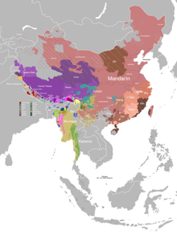
Chaudangsi is spoken on the western banks of the Kali River, facing the Nepal border along Mahakali valley. This area is located in Dharchula and Munsiyari tehsils, Pithoragarh district, Uttarakhand, India (Ethnologue). Villages include Panggu, Rongto, Rimzim, Waiku, Monggong, Chilla, Song, Sosa, Sirdang, Sirkha, Rung, Zipti, Gala, Tangkul, and Syang Khola (Ethnologue).
References
- Chaudangsi at Ethnologue (18th ed., 2015) (subscription required)
Sino-Tibetan branches |
|---|
Western Himalayas
(Himachal, Uttarakhand, Nepal, Sikkim) |
- West Himalayish
- Tamangic
- Newaric
- Kiranti
- Dhimalish
- Lepcha
| |
|---|
Eastern Himalayas
(Tibet, Bhutan, Arunachal) | |
|---|
| Myanmar and Indo-Burmese border | | "Naga" |
- Ao
- Angami–Pochuri
- Meitei
- Tangkhulic
- Zeme
|
|---|
| Sal |
- Boro–Garo
- Konyak
- Jingpho–Luish
|
|---|
|
|---|
| East and Southeast Asia | | Burmo-Qiangic |
- Qiangic
- Ersuic
- Naic
- Lolo-Burmese
|
|---|
|
|---|
Dubious (possible isolates)
(Arunachal) |
- Hrusish
- Kho-Bwa
- Miju–Meyor
|
|---|
| Proposed groupings |
- Central Tibeto-Burman
- Kuki-Chin–Naga
- Greater Bai
- Mahakiranti
- Rung
- Tibeto-Burman
- Tibeto-Kanauri
|
|---|
| Proto-languages |
- Proto-Sino-Tibetan
- Proto-Tibeto-Burman
- Proto-Loloish
- Proto-Karenic
- Proto-Min
|
|---|
Italics indicates single languages that are also considered to be separate branches. |
Bodic (Tibeto-Kanauri) languages |
|---|
West Himalayish
(Kanauric) | |
|---|
| Bodish | | Tibetic | | Central Tibetan |
- Central Tibetan (Ü-Tsang)
- Standard Tibetan
- Mugom
|
|---|
| Amdo | |
|---|
| Kham (Eastern) | |
|---|
| Southern | |
|---|
| Western | | Ladakhi–Balti (Western Archaic) | |
|---|
| Lahuli–Spiti (Western Innovative) | |
|---|
|
|---|
| Sherpa-Jirel | |
|---|
| Kyirong–Kagate | |
|---|
|
|---|
| Tshangla-East Bodish | |
|---|
| Basum | |
|---|
|
|---|
| Tamangic | |
|---|
 State of Uttarakhand |
|---|
|
| Government | | Executive |
- Governor
- Chief Minister
- Council of Ministers
|
|---|
| Legislature |
- Legislative Assembly
- Speaker
- Leader of the Opposition
|
|---|
| Judiciary |
- High Court
- Chief Justice
- Lok Adalat
- Lokayukta
|
|---|
Departments
and
agencies |
- Symbols
- Emblem
- Song
- Motto
- Foundation day
- Departments
- Environment and Forests
- Police
- Agencies
- Bar Council
- Consumer Disputes Redressal Commission
- Election Commission
- Human Rights Commission
- Information Commission
- Public Service Commission
- Womens' Commission
- Industrial Development Corporation
- Urban Development Directorate
- Waqf Board
|
|---|
|
|---|
| History | Ancient
Kingdoms |
- Uttarakuru Kingdom
- Paurava Kingdom
- Khasa Janapada Kingdom
- Himalaya Kingdom
- Parvata Kingdom
- Kirata Kingdom
- Nanda Empire
- Maurya Empire
- Kushan Empire
- Kuninda Kingdom
- Gupta Empire
|
|---|
Medieval
Kingdoms |
- Garhwal Kingdom
- Kumaon Kingdom
- Katyuri dynasty
- Chand dynasty
- Khasa Kingdom
- Raika Kingdom
- Gorkha Kingdom
- Anglo-Nepalese War
- Treaty of Sugauli
|
|---|
Colonial
Uttarakhand | Company
rule |
- Ceded and Conquered Provinces
- North-Western Provinces
- Agra Presidency
|
|---|
Crown
rule |
- United Provinces of Agra and Oudh
- United Provinces of British India
- United Provinces
|
|---|
|
|---|
Contemporary
Uttarakhand |
- Rampur Tiraha firing
- Bifurcation of Uttar Pradesh
|
|---|
|
|---|
Geography
and
Ecology | Geological
features | | Mountains | |
|---|
| Plains |
- Bhabar
- Terai
- Doab
- Ganges Basin
|
|---|
|
|---|
| Ecoregions | | Highlands |
- Western Himalayan alpine shrub and meadows
- Western Himalayan subalpine conifer forests
- Himalayan subtropical pine forests
|
|---|
| Lowlands |
- Western Himalayan broadleaf forests
- Himalayan subtropical broadleaf forests
- Terai–Duar savanna and grasslands
- Upper Gangetic Plains moist deciduous forests
|
|---|
|
|---|
|
|---|
| Demographics | Ethnic
groups | | Indo-Aryans |
- Garhwalis
- Kumaonis
- Jaunsaris
- Buksas
- Tharus
|
|---|
| Tibeto-Burmans |
- Bhotiyas
- Rajis
- Jads
- Banrawats
|
|---|
|
|---|
| Languages | |
|---|
|
|---|
Administrative
divisions | | Urban |
- Districts
- Tehsils
- Urban Local Bodies
|
|---|
| Rural |
- Parganas
- Community Development Blocks
|
|---|
|
|---|
| Politics |
- Coolie-Begar movement
- Statehood movement
- Chipko movement
- Elections
- Assembly constituencies
- Parliamentary constituencies
|
|---|
| Tourism | | Monuments |
- World Heritage Site
- Nanda Devi and Valley of Flowers National Parks
- Ramsar Wetland
- Monuments of National Importance
- State Protected Monuments
|
|---|
Chardham
Circuit | |
|---|
National
Parks |
- Gangotri
- Govind Pashu Vihar
- Jim Corbett
- Nanda Devi
- Rajaji
- Valley of Flowers
|
|---|
|
|---|
| Sports | |
|---|
Other
topics |
- Transport
- Char Dham Highway
- Char Dham Railway
- Dehradun–Haridwar–Rishikesh Metro
- Music
- Cuisine
- Economy
- Education
- School education
- Higher education
- Awards and decorations
- Uttarakhand Ratna
- Uttarakhand Gaurav Samman
|
|---|
| Districts | | Kumaon |
- Almora
- Bageshwar
- Champawat
- Nainital
- Pithoragarh
- Udham Singh Nagar
|
|---|
| Garhwal | |
|---|
Proposed
districts | |
|---|
|
|---|
Major
cities | |
|---|
Текст в блоке "Читать" взят с сайта "Википедия" и доступен по лицензии Creative Commons Attribution-ShareAlike; в отдельных случаях могут действовать дополнительные условия.
Другой контент может иметь иную лицензию. Перед использованием материалов сайта WikiSort.org внимательно изучите правила лицензирования конкретных элементов наполнения сайта.
2019-2026
WikiSort.org - проект по пересортировке и дополнению контента Википедии